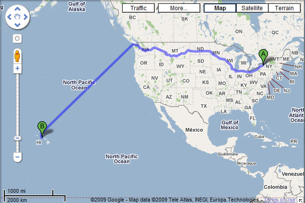
One of our students in the lab mentioned today that Google Maps provides “driving” directions to Hawaii. My ADD kicked in and I, of course, had to try it out for myself. A search from Rochester to Honolulu gives me clear directions from somewhere on Main Street in Rochester to Beretania Street in Honolulu, by way of the Seatle, WA. The trip, it says, will take me a short 15 days, 22 hours.

Google Maps clearly shows that it is possible to drive from Rochester to Honolulu...or does it?
How is this possible? Last I checked, there was no bridge and I’m not aware of a ferry service, though I suppose there could be one—but it would be an awfully slow boat give the 16 day trip Google reports.
A closer look at the actual directions reveals the answer. Just drive to Puget Sound, then jump into your kayak and paddle a reasonable 200 miles a day for the next two weeks. That’s only a little more than 8 miles an hour if you paddle non-stop, 24/7.
So why is Google doing this? Is this some kind of Easter Egg or is there some other significance? And why Puget Sound? I sure there are much more direct routes to Hawaii than going north through the sound before turning south in the ocean. I’ve tried searching Google to find out more, but nothing seems to be coming up.